
Monterey Bay Walk #1
Manresa State Beach
There are many great ways to experience Monterey Bay — kayaking, diving, whale watching, fishing, sailing. This year, and last, my favorite has been to walk it — the entire shoreline. Walking the length is very different from visiting individual spots. You feel the varied sand flats, get encouraged by a soothing ocean, witness a bounty of wildlife, and are enveloped by the expansiveness.
Monterey Bay is a crescent-shaped indentation along the central California coast. Even though my two walks have been from the north end to the south end, they’re very different. Last year’s walk was self-guided (with support) over a week from Santa Cruz to Monterey (40 miles or 64 km). This year’s walk is with a guided group over three alternating Saturdays from Capitola (just south of Santa Cruz) to Monterey (30 miles or 48 km). Each has been rewarding, but mostly, the bay environs have been amazing.
 Over three blog postings, I’ll share with you some of my photos and experiences (but you really should try this yourself). My thanks to Margaret Leonard of Slow Adventure for last year’s walk and to Sandy Lydon and his many Central Coast Secrets for this year’s walk, and for all of the great information.

Santa Cruz Harbor
In October 2012, my bay walk started at the Santa Cruz Beach Boardwalk.
By the time I reached the harbor, I couldn’t see much. Even on this autumn day, the morning was heavy with fog. Cool and cloudy is great when you’re walking long distances, but not so great while searching for a path in unfamiliar territory (I’m a south bay resident). Monterey Bay has no natural harbors (explorers tended to pass it by). Santa Cruz Harbor was built in the 1960s.

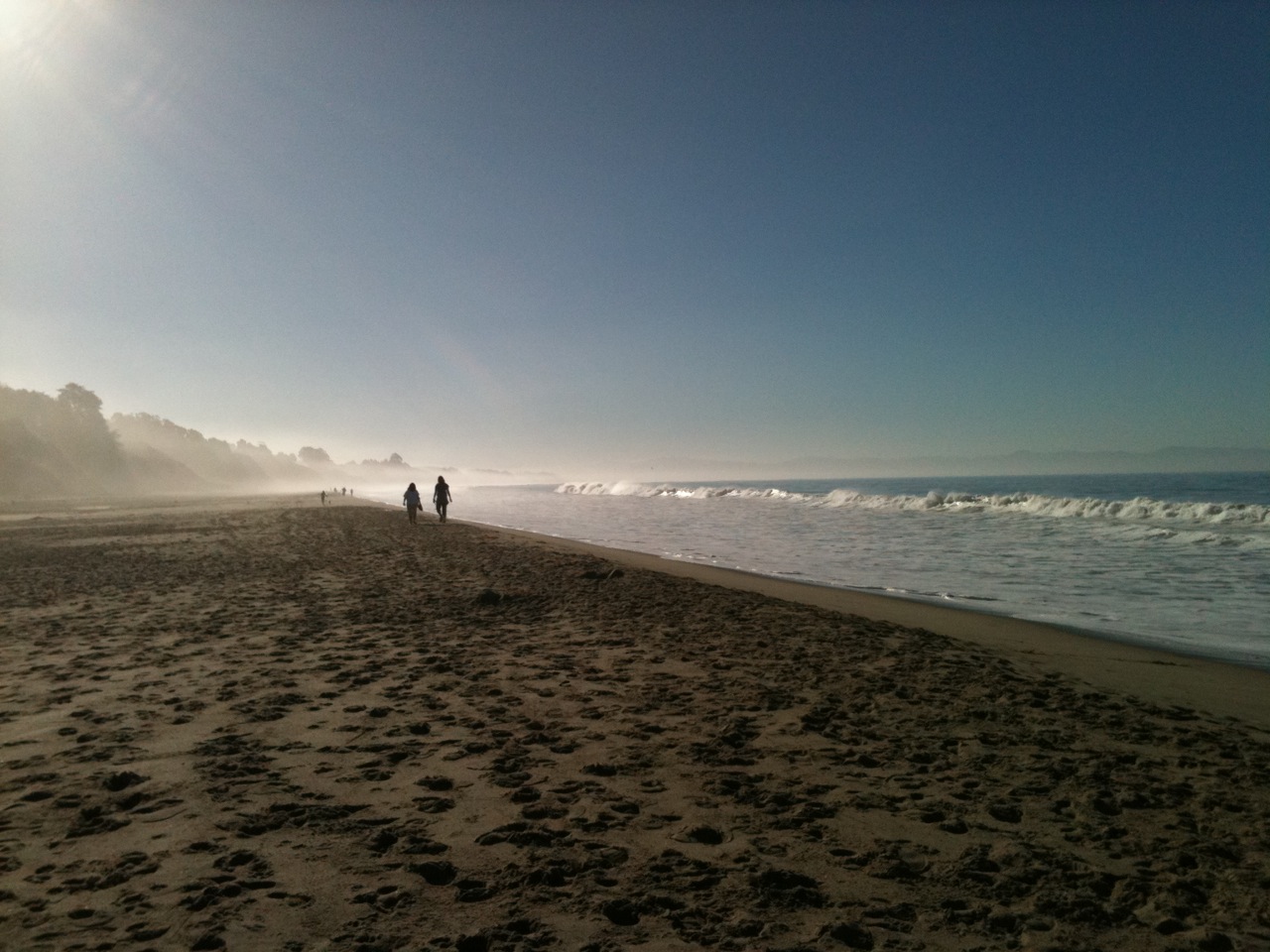
New Brighton State Beach
This year (2013) my bay walk started at New Brighton State Beach in Capitola, again with fog. Fog is a familiar beach companion during the summer (see June gloom post), but usually vanishes by August. For the long walk, the cool fog was again welcome. In the late 1850s to 1880s, this beach was called China Beach and was the site of a Chinese fishing village. Because of the geology, it’s easy for predators to funnel prey (baitfish) into the shallows. (Look at the back of the photo and you’ll see a ruffled sea surface likely caused by such predation.) This also made the spot a good place for a fishing camp.
Rio Del Mar
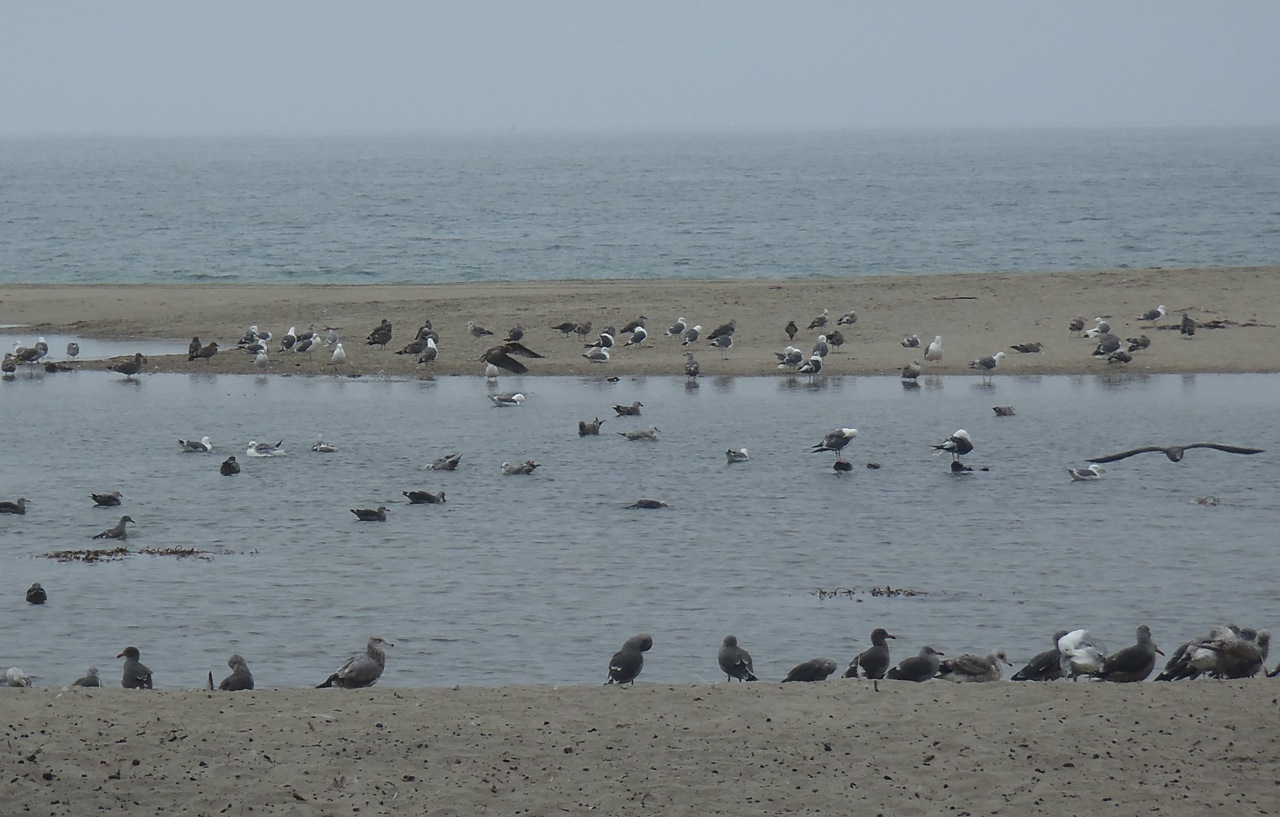
The wildlife highlight of this stretch of shoreline was the gulls. On several occasions we saw large mixed flocks of Heermann’s gulls, Western gulls and (I think) a few California gulls. This group was at the mouth of Aptos Creek in a little seaside town called Rio Del Mar (the Rio being the creek). It’s a great spot to relax.

Pajaro Dunes
All along the beach, from Rio Del Mar to Pajaro Dunes (almost nine miles) there are a number of on-the-beach developments, which surprised me when I saw them last year and concerned me this year. I understand that they were built before we knew (or implemented what we knew) about how dynamic beaches are and destructive the ocean can be. But what will these homes, businesses and communities do about the changes coming? The Sanctuary’s SIMoN website states that along the northern bay, sea cliffs are currently averaging a retreat of 0.17 to 2.1 feet (5 to 64 cm) per year and the southern coast is eroding more rapidly than any other region in the state. What will I see on this walk in 10 years? Will I even be able to walk the beach in 10 years?
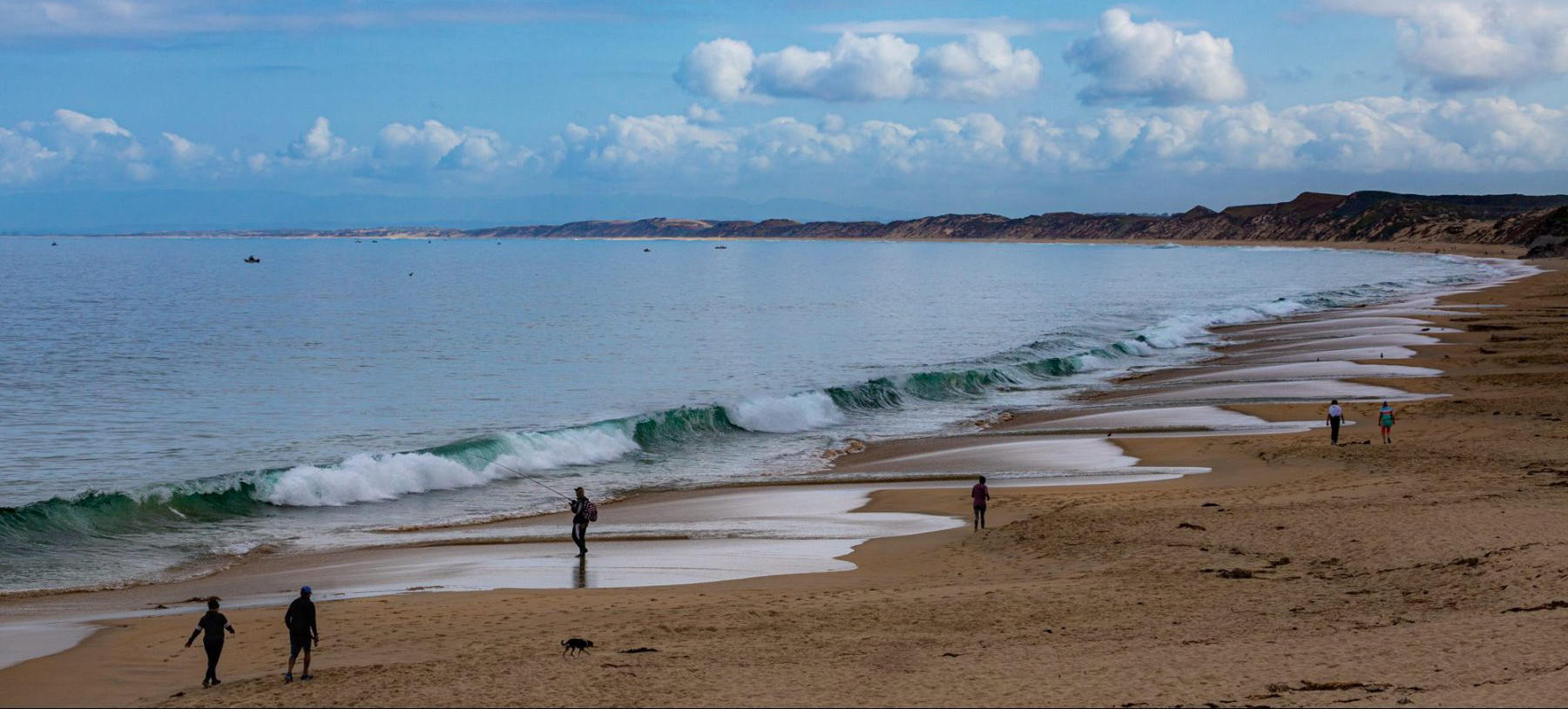
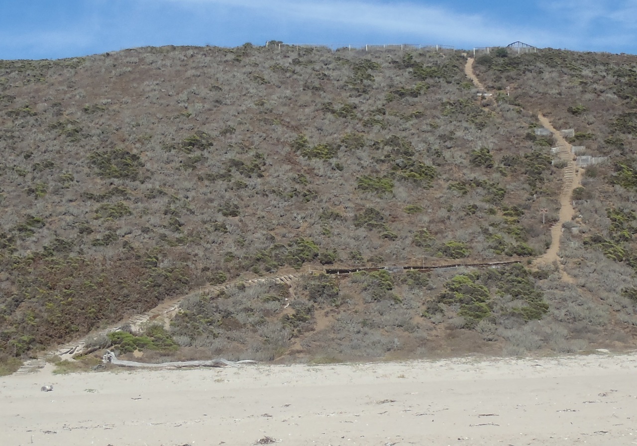
The loveliest stretch of beach, I think, is Manresa State Beach (the photo at the start of this blog post). According to Sandy Lydon, the name is from a Spanish city where the Jesuit Order was conceived and this location was once home to a Jesuit retreat center. Both times I’ve walked this beach, it has had a special feel to it. It’s a great place to stop and rest.
Sunset State Beach
All I have to say about this trail is that I’m glad I’ve never had to use it. It snakes up the dune from the beach and goes I know not where. It looks like a tough climb, especially after having walked 7+ miles (11+ km). This year the path was a welcome sight, though, because I had only a mile or two (2 to 3 km) to go. I stopped and ate my M&Ms (an afternoon treat).
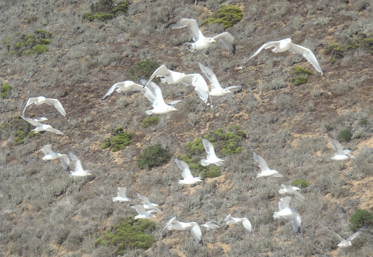
Gulls at Sunset State Beach
This is where I’ll take leave of you and end this first of my bay walk postings. Last year I continued past the Pajaro Dunes and crossed the Pajaro River (which wasn’t flowing into the ocean so was an easy crossing). This year we stopped on the north end of Pajaro Dunes at Palm Beach and didn’t get to the Pajaro River. That’s where I’ll start next time.
