Coming of fall & shorebirds
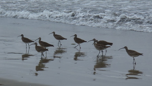
Whimbrels
I know it’s still summer (Northern Hemisphere) and we’re getting more sunshine during the day (summer fog nearly gone). But we’re also starting to feel just a nip in the air especially in the evening. Autumn is on its way. In anticipation of the change of season, I thought I’d share with you a few of our fall/winter shoreline visitors, such as these whimbrels. I anticipate I’ll see more of these shorebirds in the coming weeks and months. These shots were taken on beach walks from February through July.

Endangered snowy plovers
Snowy plovers are hard to spot and had to be pointed out to me (otherwise I probably would have missed them or maybe stepped on them). Aren’t they hard to see? Blending is great for hiding from predators, but you can see why they’re so vulnerable to beach activities.

Avocet
This singular avocet was a rare treat. I believe they’re more common in Elkhorn Slough than the open coast of Monterey Bay.
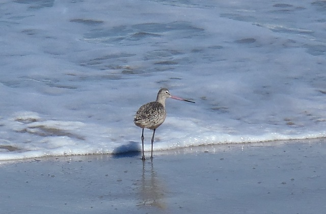
Godwit
The marbled godwit is one of the larger shorebirds I see, often among a group of whimbrels. Their two-toned bill is unmistakable.
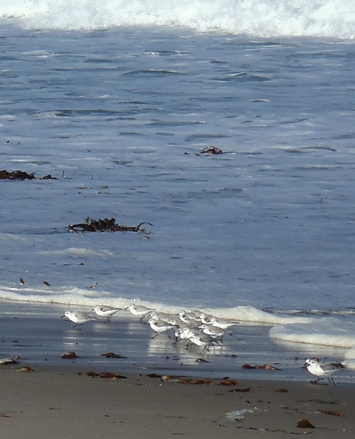
Sanderlings
I always love watching busy, bustling sanderlings. They’re movement is an illusion — they appear to roll as they run on their two short legs.
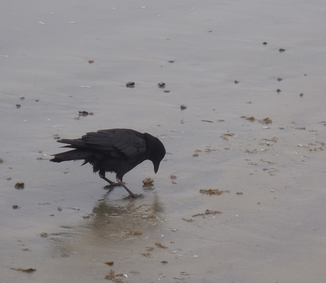
Crow acting like a shorebird
I know this last bird is not a shorebird. Yet I see crows whenever I walk the beach and they’re always probing the sand for sand crabs. Given this active feeding behavior, they sure act like shorebirds. They’re also always interesting to watch as they work the beach. And so I’m including them here. I hope you enjoy the change of season wherever you are.
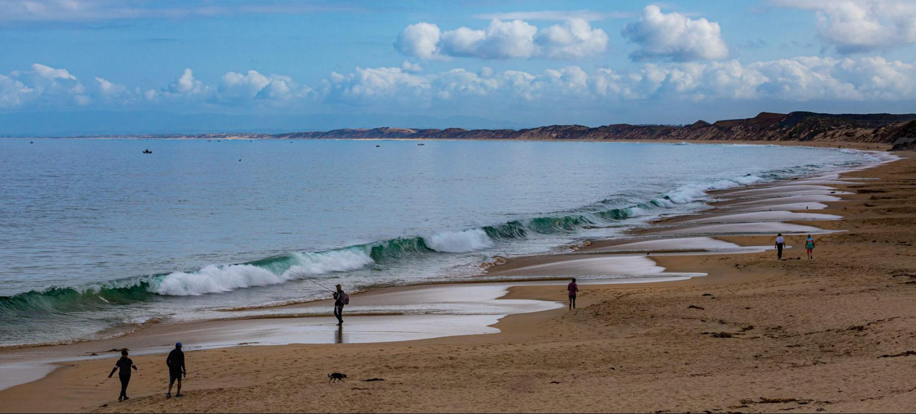
Monterey Bay Walk #2
Zmudowski State Beach
Yesterday was a lovely Monterey Bay day. It was also the second leg of my walk with 25 other local walkers guided by historian Sandy Lydon. We started at Zmudowski State Beach north of Moss Landing (about mid-point on the bay’s shoreline) and were headed to Marina State Beach about 10 miles (16 km) to the south. (This day closely followed the third day of my walk last year with Slow Adventure. See my earlier post about walking the north part of the bay.)
Moss Landing
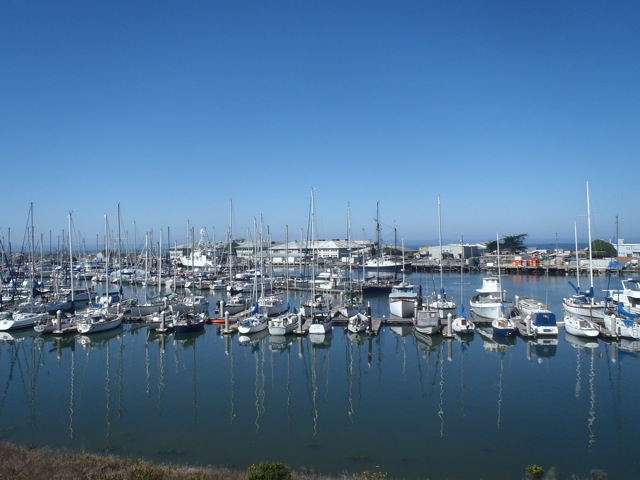
We were expecting a warm day (near 80°F/27°C — actually hot for us) so enjoyed the cool morning air. Zmudowski Beach is named after Mary Zmudowski (pronounced mud-us-key), a local teacher who donated the property to the state in 1950. After about an hour of walking, our first big stop was Moss Landing. This harbor is home to an active fishing community, the esteemed Monterey Bay Aquarium Research Institute (MBARI) (started in 1987), and Phil’s Fish Market & Eatery, a fairly famous spot for fresh seafood. The town got its start when Charles Moss built wharves here in the 1860s to ship grains from the Salinas Valley. This spot was also home to a whaling station (where MBARI currently sits) from 1918 to 1927. The harbor district was established in 1945.
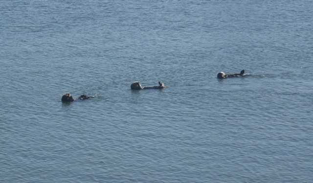 For me the most interesting part of Moss Landing is the north end of the harbor (because of the sea otters, harbor seals and sea lions) and the entrance to Elkhorn Slough (one of my favorite places for kayaking and birding on Monterey Bay). This morning about 30 sea otters (Enhydra lutris) rested and groomed just below us as Sandy talked about the flow of the Salinas River north and south of Moss Landing at various times. To get beyond Moss Landing we detoured from the beach to Highway 1, passed the harbor (over the water), and then walked with the Old Salinas River. This is an interesting section because you can choose to walk along the old river and its marshes or along the beach and its dunes. Both paths are pleasant and unique.
Salinas River State Beach
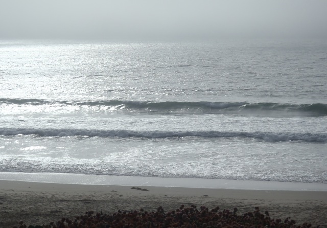
We stopped for lunch at the Molera end of the Salinas River State Beach where you can rent horses for a beach ride and get a professional photo taken. (I know this is sounding like a travelogue, but our California State Beaches are really wonderful ways to connect to the outdoors and they desperately need our support. Plus the horses were a surprise and Sandy arranged for a group photo.) At this time we were joined by a familiar local — fog. The temperature dropped and the wind added a chill. (Most days I would have been bummed to lose the sunshine, but I must say I wasn’t sorry to see a cooling fog bank roll in. We still had 4 to 5 miles [7 km] to go!)

Mulligan’s Hill and the Salinas River
About a mile (1.6 km) south of the horses there’s the mouth of the Salinas River, Mulligan’s Hill and the barge. The Salinas River is our largest local river and runs about 150 miles (240 km) from southeast to northwest creating the Salinas Valley, certainly one of California’s most productive agricultural regions (I thrive on the fresh vegetables and fruits we have here year-round). This year a sand bank barred the river from reaching the ocean, and so our crossing was easy. (Last year I had to wade across through knee-high waves washing over the sand bank and into the river mouth.) At the river mouth there’s a huge sand dune (about 58 feet/17 m high) called Mulligan’s Hill (after an Irishman). But long before Mulligan, Gaspar de Portolà and his expedition in 1769, on a trek from San Diego in search of the fabled Monterey harbor, climbed this hill and decided to continue north.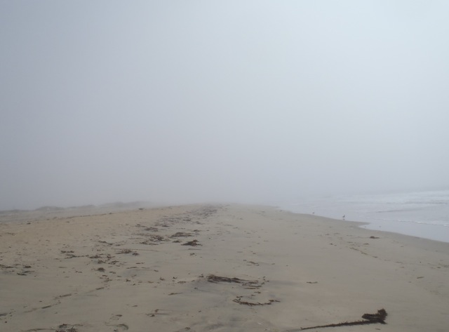 (Looking at Monterey Bay, they probably couldn’t see it well, which is understandable given what we were able to see from the beach at this point.) Even though they didn’t find Monterey, on their travels north, they did find what would later become Santa Cruz and San Francisco. (Some would consider that pretty good success for a failure. The next year he did find Monterey.)
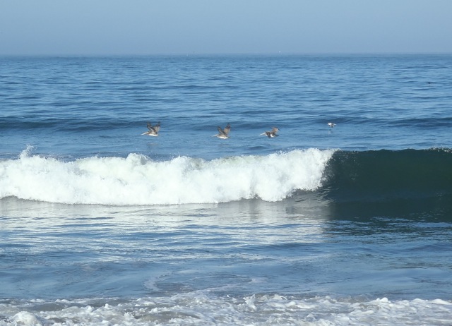
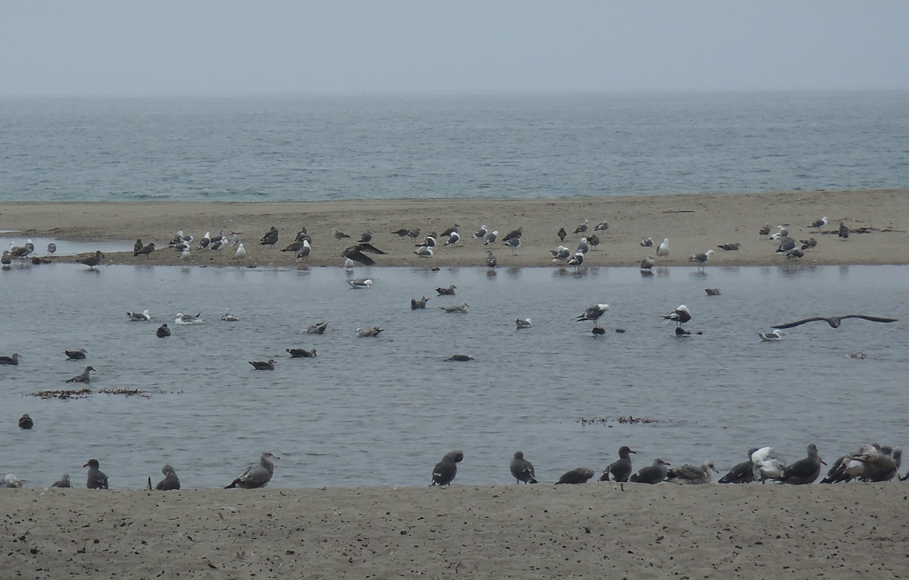
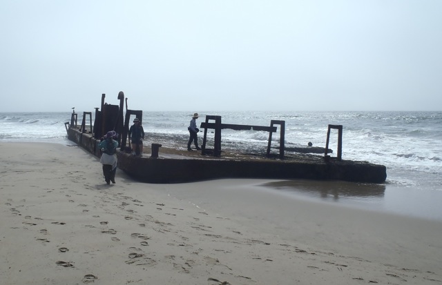 Our next beach sighting was an old barge that no one seems to know much about except that it’s on the beach. This is a rough section of coast and supposedly someone was towing this barge and somehow it got loose and ended up here. This year most of it was exposed; last year most of it was covered by sand and I almost missed it when I walked past. I’m amazed how much the sand along these beaches can move. This stretch of beach is more for wildlife than people and is designated the Salinas River National Wildlife Refuge. We saw large flocks of gulls (mostly Western gulls of various ages) and sanderlings. This is also home to the Western snowy plover (Charadrius alexandrinus), designated a threatened species due to loss of nesting habitat (they nest on the sand) and human disturbances (people, pets and their activities on the sand). This remote spot is hopefully a good place for them.
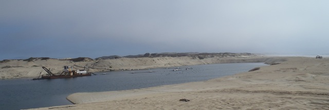 The big surprise to me the last time I walked this stretch of beach was our next stop. It’s an active sand-mining operation on the beach. Although our beaches have a long history of being commercially mined (since 1906), I didn’t realize any were still operational. This is the Cemex Lapis Plant (Cemex is the current owner, but there have been many others). The high-quality sand is used by golf courses, in filtration systems, on construction projects and in gardens and nurseries. There’s controversy associated with the plant’s operation. Some claim it’s responsible for the erosion that’s been occurring along south bay shores for decades, while others aren’t so sure if that’s the only or primary cause. Some people just don’t like the operation on the beach even if it does bring much-needed revenue to the city of Marina. It’s an interesting site and operation to watch. It certainly provides a view of what was once a major industry along our beaches from Marina to Point Lobos.
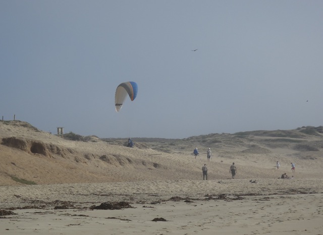
Marina State Beach
The walk from the Cemex plant to Marina State Beach (our final destination) was a quick mile (we were exhausted and in need of bathrooms). Marina is nearly always windy and well known for hang gliders and kite fliers. Today didn’t disappoint. A paraglider was circling overhead when we arrived. We scurried up the dune to use the facilities, said our goodbyes and ended the day agreeing to meet in the same spot in two weeks for the final leg of our bay walk.
Marina State Beach
My thanks to Sandy Lydon for all of the great information (errors are mine),
his logistics team (especially Annie) for keeping us organized, and the beach walkers who shared the day with me.
Monterey Bay Walk #1
Manresa State Beach
There are many great ways to experience Monterey Bay — kayaking, diving, whale watching, fishing, sailing. This year, and last, my favorite has been to walk it — the entire shoreline. Walking the length is very different from visiting individual spots. You feel the varied sand flats, get encouraged by a soothing ocean, witness a bounty of wildlife, and are enveloped by the expansiveness.
Monterey Bay is a crescent-shaped indentation along the central California coast. Even though my two walks have been from the north end to the south end, they’re very different. Last year’s walk was self-guided (with support) over a week from Santa Cruz to Monterey (40 miles or 64 km). This year’s walk is with a guided group over three alternating Saturdays from Capitola (just south of Santa Cruz) to Monterey (30 miles or 48 km). Each has been rewarding, but mostly, the bay environs have been amazing.
 Over three blog postings, I’ll share with you some of my photos and experiences (but you really should try this yourself). My thanks to Margaret Leonard of Slow Adventure for last year’s walk and to Sandy Lydon and his many Central Coast Secrets for this year’s walk, and for all of the great information.

Santa Cruz Harbor
In October 2012, my bay walk started at the Santa Cruz Beach Boardwalk.
By the time I reached the harbor, I couldn’t see much. Even on this autumn day, the morning was heavy with fog. Cool and cloudy is great when you’re walking long distances, but not so great while searching for a path in unfamiliar territory (I’m a south bay resident). Monterey Bay has no natural harbors (explorers tended to pass it by). Santa Cruz Harbor was built in the 1960s.

New Brighton State Beach
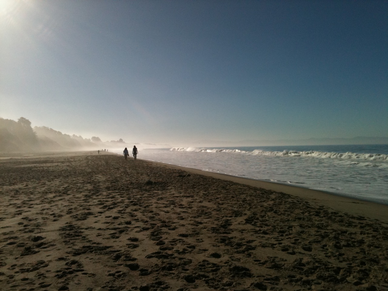
This year (2013) my bay walk started at New Brighton State Beach in Capitola, again with fog. Fog is a familiar beach companion during the summer (see June gloom post), but usually vanishes by August. For the long walk, the cool fog was again welcome. In the late 1850s to 1880s, this beach was called China Beach and was the site of a Chinese fishing village. Because of the geology, it’s easy for predators to funnel prey (baitfish) into the shallows. (Look at the back of the photo and you’ll see a ruffled sea surface likely caused by such predation.) This also made the spot a good place for a fishing camp.
Rio Del Mar
The wildlife highlight of this stretch of shoreline was the gulls. On several occasions we saw large mixed flocks of Heermann’s gulls, Western gulls and (I think) a few California gulls. This group was at the mouth of Aptos Creek in a little seaside town called Rio Del Mar (the Rio being the creek). It’s a great spot to relax.

Pajaro Dunes
All along the beach, from Rio Del Mar to Pajaro Dunes (almost nine miles) there are a number of on-the-beach developments, which surprised me when I saw them last year and concerned me this year. I understand that they were built before we knew (or implemented what we knew) about how dynamic beaches are and destructive the ocean can be. But what will these homes, businesses and communities do about the changes coming? The Sanctuary’s SIMoN website states that along the northern bay, sea cliffs are currently averaging a retreat of 0.17 to 2.1 feet (5 to 64 cm) per year and the southern coast is eroding more rapidly than any other region in the state. What will I see on this walk in 10 years? Will I even be able to walk the beach in 10 years?
The loveliest stretch of beach, I think, is Manresa State Beach (the photo at the start of this blog post). According to Sandy Lydon, the name is from a Spanish city where the Jesuit Order was conceived and this location was once home to a Jesuit retreat center. Both times I’ve walked this beach, it has had a special feel to it. It’s a great place to stop and rest.
Sunset State Beach
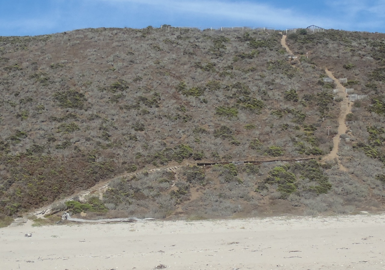
All I have to say about this trail is that I’m glad I’ve never had to use it. It snakes up the dune from the beach and goes I know not where. It looks like a tough climb, especially after having walked 7+ miles (11+ km). This year the path was a welcome sight, though, because I had only a mile or two (2 to 3 km) to go. I stopped and ate my M&Ms (an afternoon treat).
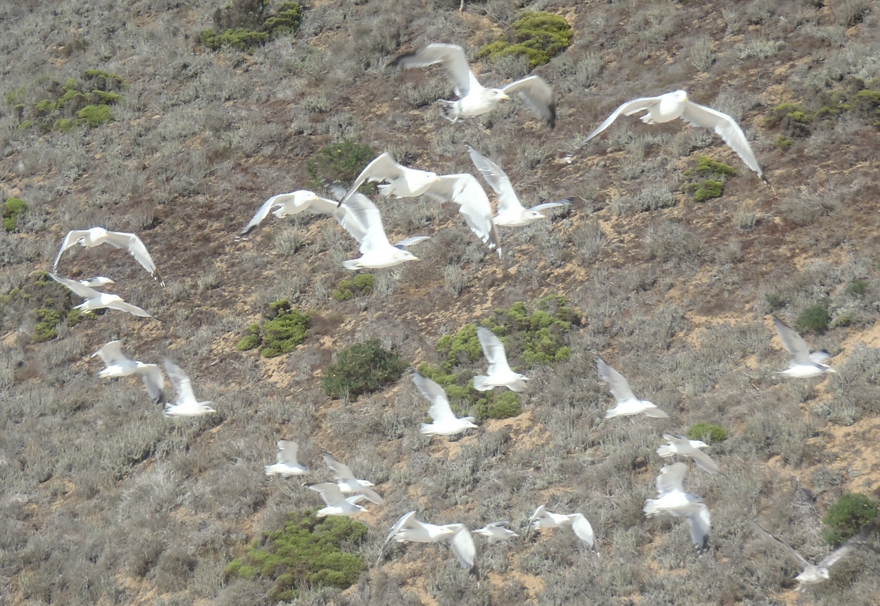
Gulls at Sunset State Beach
This is where I’ll take leave of you and end this first of my bay walk postings. Last year I continued past the Pajaro Dunes and crossed the Pajaro River (which wasn’t flowing into the ocean so was an easy crossing). This year we stopped on the north end of Pajaro Dunes at Palm Beach and didn’t get to the Pajaro River. That’s where I’ll start next time.
~~~~~~~~~~~~~~~~~~~~~~~~~~~~~~~
Sources & References
California Department of Parks and Recreation: State Parks
Manresa State Beach
New Brighton State Beach
Palm Beach
Sunset State Beach
City of Santa Cruz: History
Santa Cruz Port District: History of the Harbor
SIMoN Monterey Bay National Marine Sanctuary: Climate Change
Monterey Bay August morning
 Fog this morning
gave way
to lovely cumulus —
an odd little August
dry weather front.
Could use some rain!
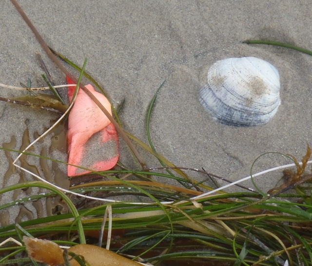
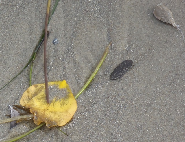
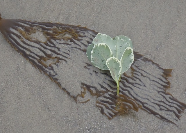
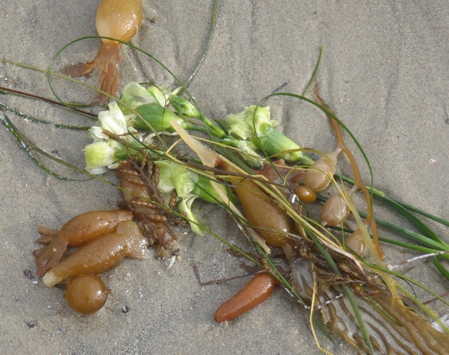
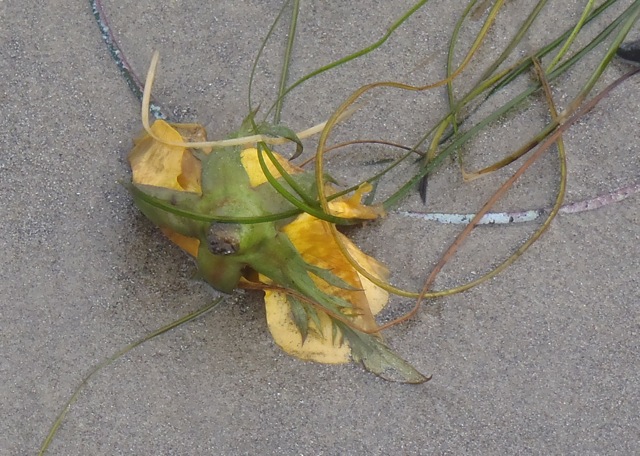
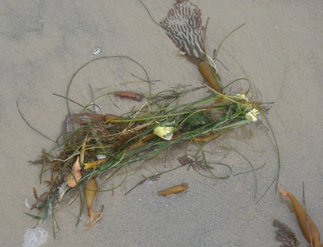
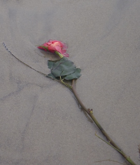
Beached sea flowers
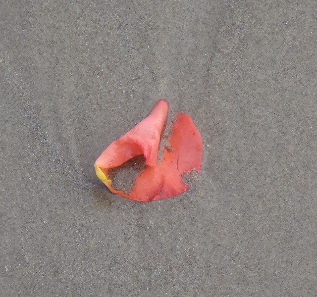 Monday’s tideline was littered with flowers.
They had been washed and tossed in the sea.
Left on the sand, they were foreign and captivating.
What silent stories rode ashore with them?