
Carmel Bay is a lovely, exposed bay just south of Monterey Bay, and a good walking site almost any day.  It’s nestled between a southern rocky peninsula that is Point Lobos State Natural Reserve and a northern rocky peninsula that includes Pebble Beach — about 4 miles (6.4 km) of ocean, rocky shores and sandy beaches. The town Carmel (officially Carmel-by-the-Sea) straddles mid-coast. From a land perspective, Carmel Bay is separate from Monterey Bay. From an ocean perspective, submarine canyons — the Monterey Canyon System — connect the smaller Carmel Bay with the larger Monterey Bay. Because of that connection, and frequent Carmel visits, I feel justified writing about Carmel Bay in a Monterey Bay blog.
After a mild winter storm last week, I walked the Carmel Bay shoreline from south to north — from Point Lobos to the Carmel-Pebble Beach border. I’ve never walked the entire stretch before. The day was cloudy, breezy and cold, but that didn’t matter because the scenery was so amazing.  (I’ll probably be using many superlatives in this post as this is a spectacular coastline.)
I started my walk at Point Lobos State Natural Reserve, which according to the map and guide is considered “the crown jewel of California’s state park system.” Artist Francis McComas claimed (and I agree) it’s “…the greatest meeting of land and water in the world.” 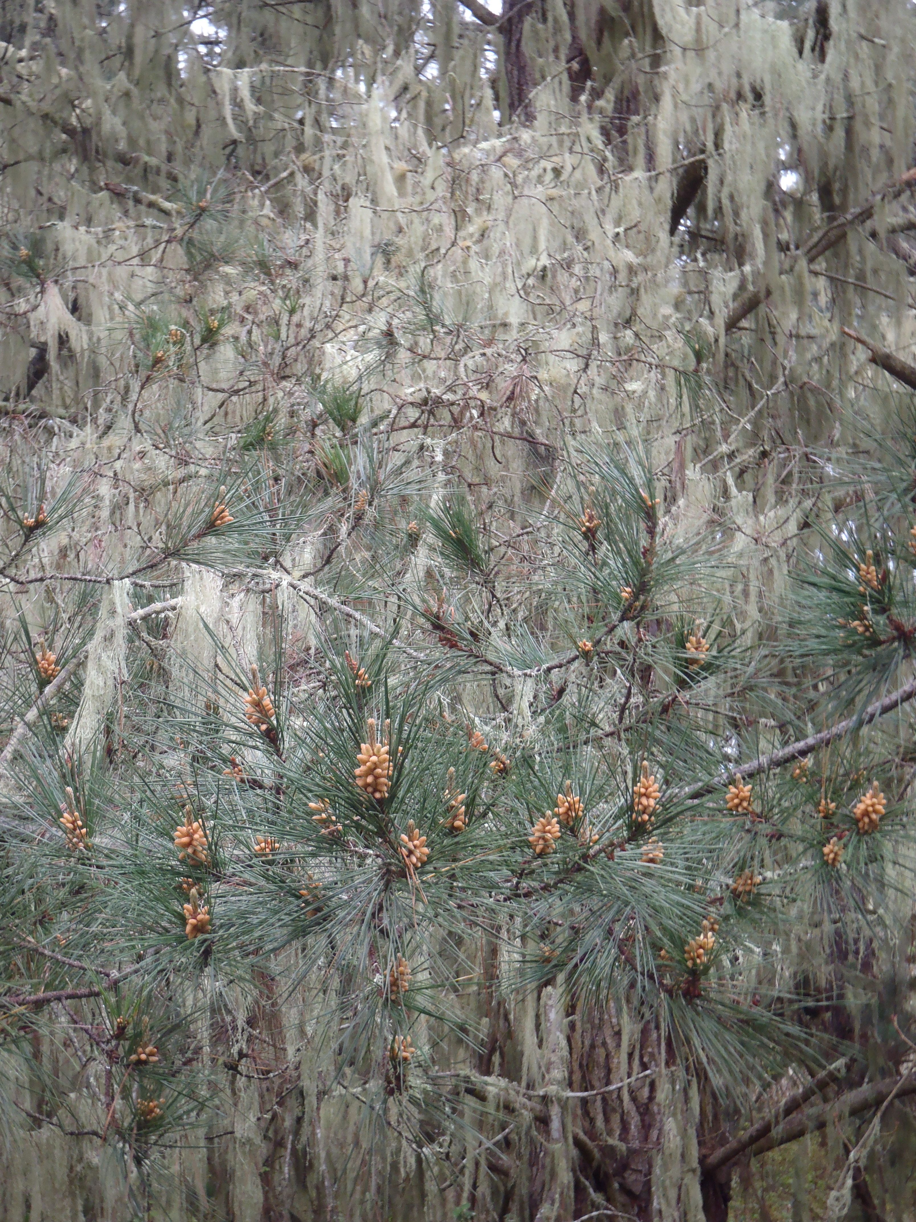 Point Lobos (referring to the sea lions on rocky points) is a mosaic of headlands and coves shaped by tectonics and pounding surf, as well as forests and meadows buffeted by stiff winds, blanketed in drifting fog and baked dry the rest of the time. (You could easily spend an entire day exploring this place.) It’s a dynamic, life-rich environment that presents a different face each time I visit. This time there were signs of winter (wet from rain) and spring: leafy green poison oak, dusty yellow pine pollen and bright flowering Indian paintbrush. With hardly anyone else there, I was able to soak in the varied, and sometimes eerie, beauty.
To continue my stroll toward Carmel, unfortunately, I had to walk about a half-mile (.8 km) along Highway 1. It’s a very busy road. There is a broad shoulder and the walk is short, so it’s not too bad, however, a more natural path between the park boundary and Monastery Beach would certainly enhance the experience. Along the way, I was stopped by two different sets of visitors seeking directions. (I guess I looked like I belonged.)
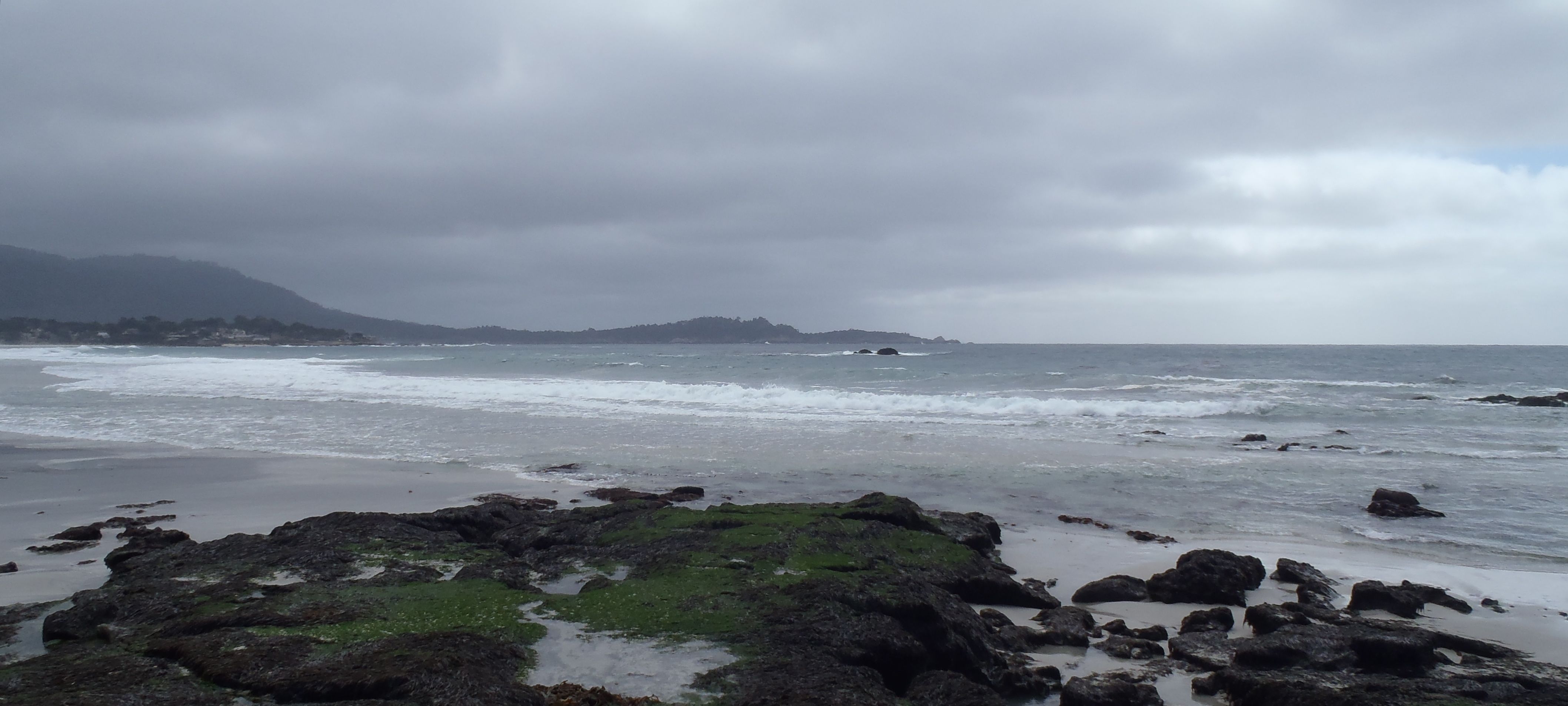
The next leg was Monastery Beach (the local’s name due to the nearby Carmelite Sisters Monastery), but also shown on maps as San Jose Creek Beach (due to the creek that flows to it, although I’ve never heard anyone call it that).  This beach is awe-inspiring and, for locals, fear-inducing. It’s gorgeous with pebbly sand and breathtaking surf. On a sunny day, it’s irresistibly attractive. What many visitors don’t realize, even though there are warning signs, is that this beach is deadly — people die here just about every year. (Some call it Mortuary Beach, but I’ve only seen that in the media.) The attractive surf is extremely dangerous due to its power, the steep angle of the beach and the coarse sand that gives way underfoot. It’s easy to be hit by a wave, get swept away and drown. The beach also attracts SCUBA divers. The diving is probably exquisite, but again, the water is rough and only for the most experienced on the calmest days.
Last year I kayaked along this side of Point Lobos with friends and Monterey Bay Kayaks guides. We launched and landed successfully from the south end of Monastery Beach making use of the water-calming kelp beds to protect us. I’m not sure I’d do it again though. (I’ll post about that adventure another time.) Trekking across the loose sand of Monastery Beach was challenging, but necessary to reach the Carmel River Beach Trail and continue on my way to Carmel.
The Carmel River Beach Trail (map) is part trail and part service road, and was a wonderful surprise. It was a broad path that followed a rocky shore dotted with beaches. It looked like a great secluded spot to enjoy on a warm day, but was chilly in the wind and so I kept walking to where the Carmel River flows into the ocean (sometimes). 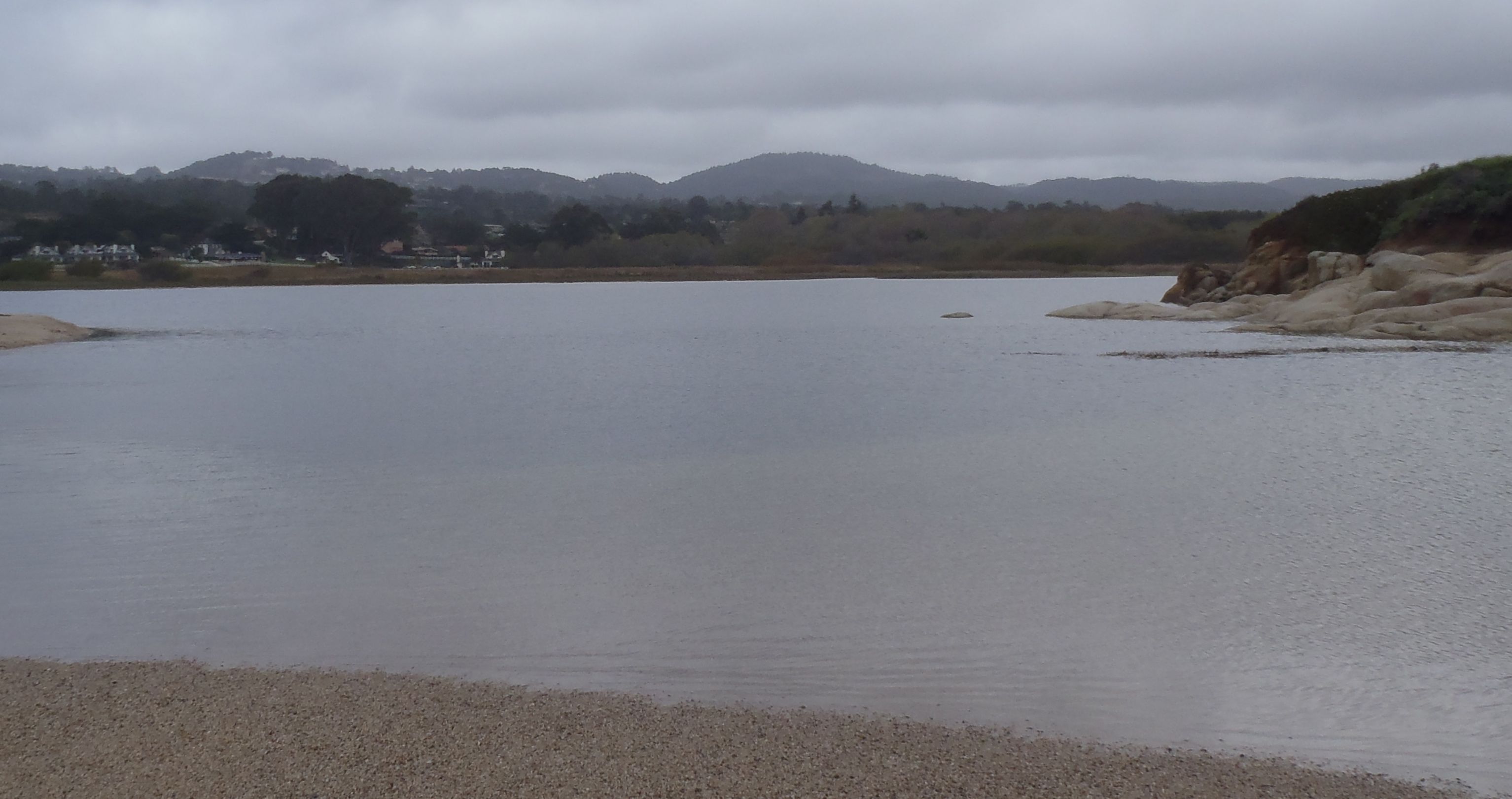 Where river and sea met was a broad, shallow freshwater lagoon. In the water on this day, there were a flock of gulls, a few cormorants and two pairs of buffleheads in full breeding plumage.
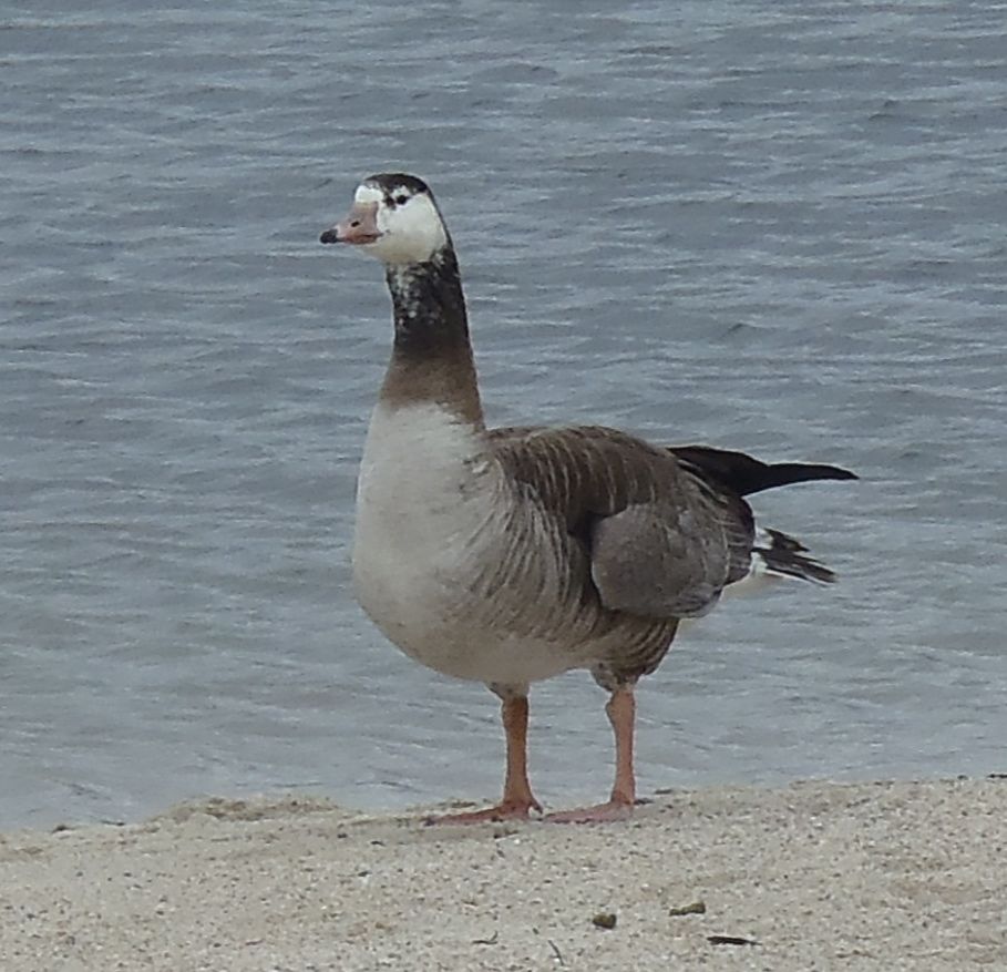 I also spotted an odd bird on the shore, and still haven’t figured out what it was (any guesses?). It was about the size of a Canada goose, maybe a bit smaller, but as you can see, its coloration, neck and feet were all wrong (right for this goose, but wrong for identification). My best guess was that it may be a Canada goose hybrid, but with what?
Blocking the mouth of the Carmel River was a sand berm (which sometimes is cut open to let the river flow into the sea and not flood homes). However, this year we’ve had little rain (one of our driest winters on record) and the river was just a trickle. (I got only one shoe wet during my crossing.) 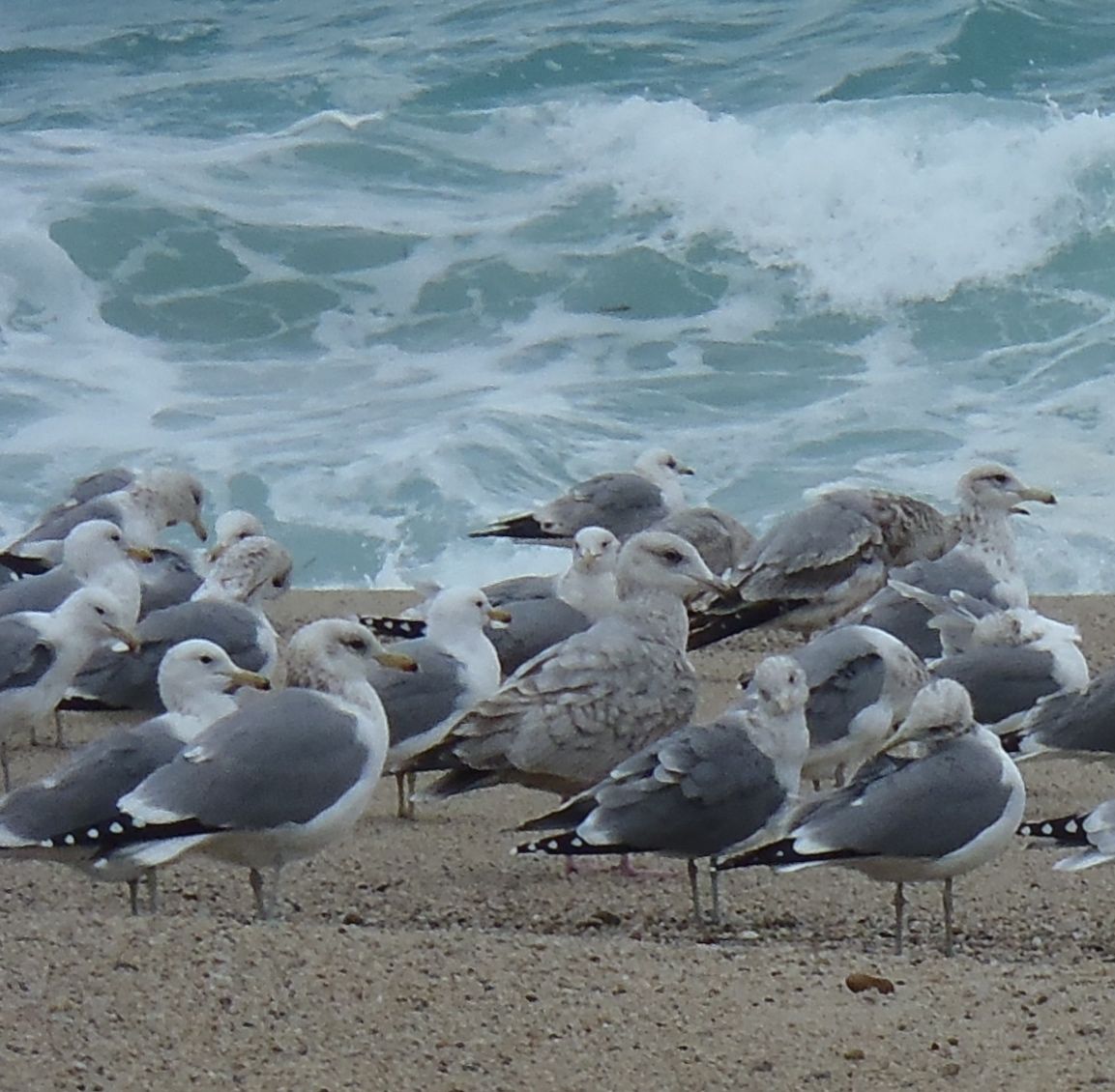 All along the berm were gulls — different species and age classes. I identified the larger ones as Western gulls (year-round residents) and most of the smaller ones with yellow legs as California gulls (which are now starting to migrate out of our area). When I have time, this could be a great place to work on my gull identification skills, especially when we have so many over-wintering species and there’s such a crowd of gulls.
After crossing the northern section of Carmel River State Beach, my path took Scenic Road around Cypress Point, still along the coast but also past Carmel homes. This area is all part of the Carmel Bay State Marine Conservation Area (I’ve written more about local state marine protected areas in a previous post). The tidepools on my left were spectacular, as were the homes on my right. Scenic Road leads to the dog-friendliest city and beach that I know. 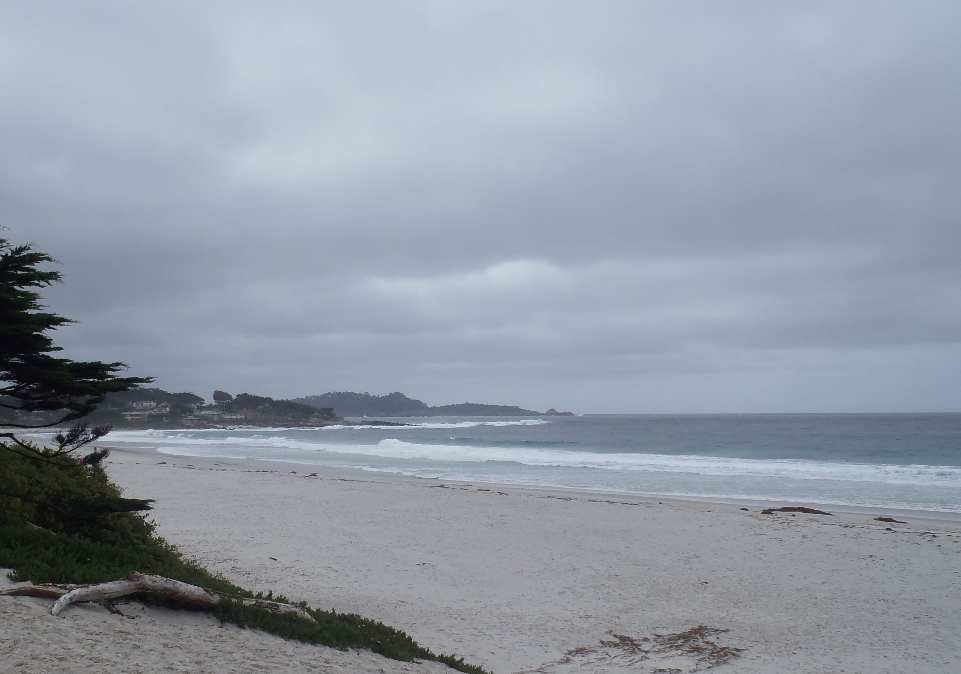 We raised our German shepherd on Carmel Beach, and I’m sure she’s a friendlier and healthier dog because of it. The beach is leash-free for well-behaved canines. Dogs of all sizes and ages get to socialize and learn proper manners from both canines and people But I have push-pull about the dogs running free. It prevents shorebirds from feeding along the beach. We’ve never allowed our dog to chase birds, but not everyone is so mindful. My justification is that there are many other areas along our coast where wildlife are protected from human disturbances. And, I think Carmel’s economy is closely tied to its welcoming policies toward canine companions. I certainly appreciate it when I visit with my dog.
I continued my walk until the rocks jutting into the surf blocked my progress at the Carmel-Pebble Beach boundary. If I had wanted to continue, I could have by following the California Coastal Trail (Section 11) off the beach (using a set of wooden stairs) and winding along trails through the Del Monte Forest to Fanshell Beach and 17-Mile Drive on the north side of Pebble Beach. That’s a walk I plan to tackle another day.
 I looked back at Point Lobos, where I had started. Noticing that the sky was turning dark and it was getting windier, I decided it was a good time to finish. I trudged off the beach into Carmel (that hill is tough) and ended my walk with a treat at Doris Day’s Cypress Inn.
~~~~~~~~~~~~~~
Sources
